Heritage
Bekal Fort: the walls, the sea and the best time of day
Kerala's largest fort is usually reduced to one photograph of laterite ramparts above the sea. Spend a little longer and it becomes a lesson in coastal defence, trade and the weather.
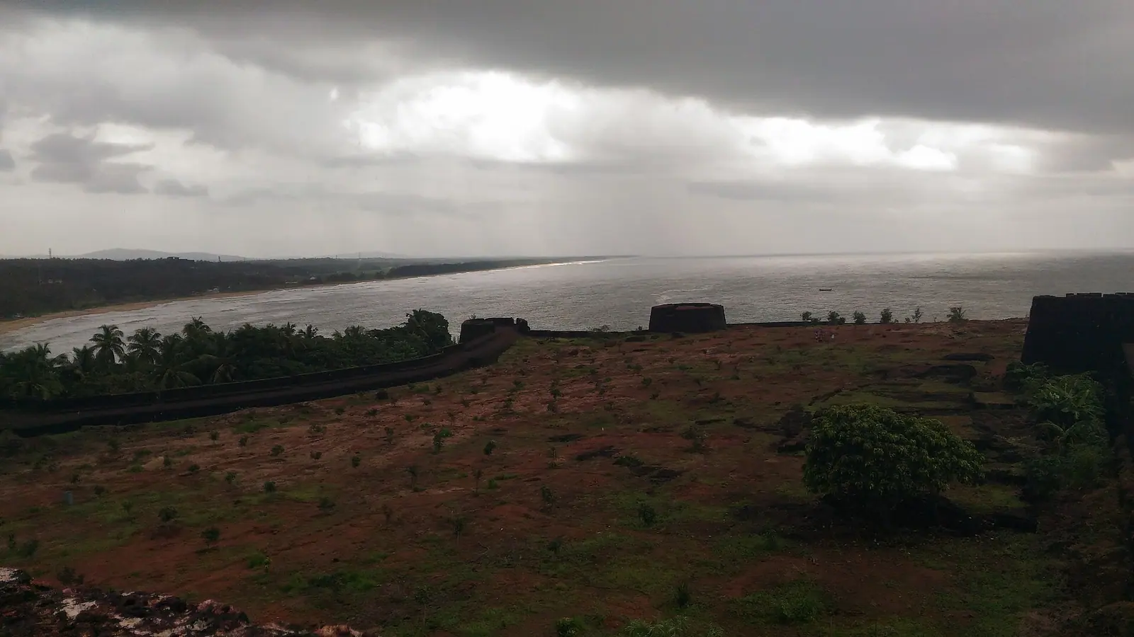
Bekal Fort is the image most people carry of Kasaragod before they arrive: a long, low curve of laterite wall with the Arabian Sea beyond it, palm trees leaning inland and a few visitors reduced to silhouettes on the rampart. The photograph is accurate, but it flattens the place. Bekal is not a scenic ruin. It is a coastal fort built to control a stretch of water, and its shape only makes sense when you read it from the sea side.
A fort built for the sea
The fort is generally attributed to Shivappa Nayaka of the Keladi Nayaka kingdom in the seventeenth century, part of a chain of coastal strongholds that stretched along the Kanara and Malabar coasts. The date and the exact sequence of builders are debated, as they are for most forts in the region. What is clearer is the purpose: observation, storage, toll collection and defence of a harbour and river route. Bekal later passed through the hands of Mysore and then the British, and its military importance faded as the political map changed.
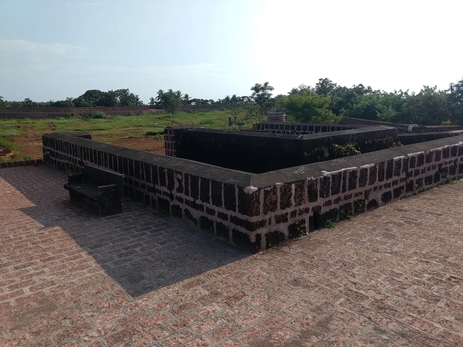
That layering matters. A fort is not a single building but a series of decisions made by different administrations. The laterite blocks, the broad ramparts, the gateways and the water systems were repaired, extended or abandoned at different times. Walking the perimeter is a way of reading those decisions, even without a guide. Look for the thickness of the wall, the angles of the bastions and the way the main enclosure turns its back to the land and opens to the sea.
What to look for inside
The fort is entered through a gateway and opens into a large enclosure with a stepped tank, the remains of buildings, a magazine and an observation tower. The tower is the visual climax: a circular structure with openings that frame the sea and the coast in both directions. It is also the busiest spot, so go early or late if you want the view without a queue of people taking the same photograph.
- Walk the full rampart rather than stopping at the first viewpoint; the northern stretch is usually quieter.
- Look at the drainage channels and tanks; water storage is what made a coastal fort viable.
- The fort is exposed, with very little shade. Carry water and wear a hat.
- The laterite is uneven and can be slick after rain; sandals with grip are better than smooth soles.
- There is little interpretive signage, so read up beforehand or hire a local guide if you want the history.
The beach, the backwaters and the light
Bekal beach runs north of the fort, a broad stretch of sand with fishing boats and a low-key line of stalls. It is not a resort beach, and that is part of its appeal. Swimming conditions vary with the season and the currents; ask locally rather than assuming a calm-looking sea is safe. South of the fort, the backwaters and the Kasaragod–Bekal area offer a different landscape of canals, small boats and paddy fields, best seen slowly and without a fixed itinerary.
The best time of day is the obvious one for a reason. In the early morning the stone is still cool, the light comes in low from the east and the fort belongs to walkers and birds. In the late afternoon the sea turns silver and the walls glow, but the site can be crowded with groups. The middle of the day in April and May is punishing. The monsoon is dramatic but the exposed walkways and the sea are not at their most welcoming.
Sources & notes
- Kerala Tourism — official state tourism portal · checked 2026-10-22
- Wikipedia — place and history reference · checked 2026-10-22
Last updated 24 October 2026. Prices, opening hours and transport should be confirmed with official sources before travel.
Hello Kerala Publisher
Hello Kerala's editorial desk.
Found an error or an outdated detail?
Tell us