Nature
Malarikkal: a water-lily wetland that is still a paddy farm
A working field near Thiruvarppu that turns white for part of the year. How to see it without walking into the crop, and why the bloom keeps its own calendar.
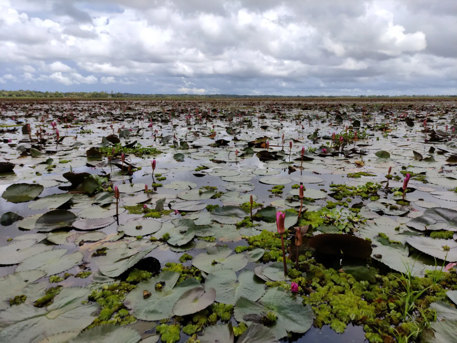
Malarikkal is a small place near Thiruvarppu in Kottayam district, and for a stretch of the year it does one thing extremely well: the shallow water lying over its paddy fields carries water lilies, and a flat field of white flowers under a low sky is genuinely worth a detour. The district administration lists it as a village-tourism destination, placing it near Thiruvarppu and Kumarakom, which is exactly how it feels on the ground — a farming area that visitors pass through rather than a site arranged for them.
That distinction is the whole guide. Malarikkal is not a lily garden. It is farmland that holds water, the flowers are a response to that water, and the field belongs to the family that grows in it. Understand that before you arrive and the visit is straightforward. Arrive expecting an attraction with a gate and a car park, and you will spend the morning looking for something that is not there.
Why the bloom is not a date in the diary
A field of lilies is an event with conditions attached: enough water standing for long enough, the right point in the crop cycle, and a plant that has spread across the shallow ground. Drain the field, change the water level, or come after the flowers have been cut back, and the same place is simply a wet field with a few birds on it.
So the honest answer to "when should I go" is that the reliable information is local and current rather than editorial. Ask in Kottayam — the district tourism office, a homestay, a boat operator working the backwaters — what the fields are doing this week. A photograph posted three weeks ago is not a forecast, and no website, including this one, can tell you what a farmer will have done to a field by the weekend.
Getting there, and what the district publishes
The district administration gives Kottayam railway station as about 7.6 km away and the KSRTC bus stand as about 6.9 km. Those are published figures rather than a measured drive, and the last stretch runs through village roads where a sign may be missing and a turning may be unmarked. Treat the numbers as the start of a route, not the end of one.
- Come early. The light is softer, the fields are quieter, and there is time to move on before the heat builds.
- Allow an hour or two at most; this is a stop, not a day out.
- There are no facilities we could verify — no confirmed toilets, food or step-free access over wet ground. Assume none and plan around it.
- If accessibility matters for your group, ask before you set out rather than discovering the answer at a bund.
- Carry water and take everything away with you; litter in a wetland does not stay where it falls.
Seeing it without damaging it
The single most important rule is not to walk into the fields. A bund is a boundary and a path at the same time, and stepping off it to get closer to a flower compacts the soil, breaks the edge and damages the crop the water is there to grow. Photograph from the bund, from the road or from a boat if one is running. Do not wade, do not pick the flowers, and do not let children paddle — the water is shallow but the ground underneath is a working field and the edges are soft.
Ask before photographing people at work, and do not block a farmer's access to a field while you frame a shot. If a boatman says a channel is closed or a field is off limits, that is the answer rather than a negotiating position.
The arrangement that makes it work
Malarikkal has been described as a case of tourism earning something for the farmers rather than only for the operators. Reporting in July 2025 set out local arrangements for boats and parking and framed the model around farmer income, which is the version of this worth supporting. That reporting is a description of how things were organised at the time, not a price list or a timetable; parking, boat rides and any charges can change with the season and with who is running them, so confirm on arrival rather than quoting a figure you read somewhere.
The practical version is simple: pay whoever is actually doing the work rather than a middleman, buy from the shop at the junction, and keep the visit short and small. A place that earns from visitors has a reason to keep the fields worth visiting, and a place that is overrun stops being worth the trip for everyone.
Where it fits in a Kottayam trip
Malarikkal works best as a morning stop inside a wider day. Thiruvarppu is close, Kumarakom and the Vembanad lakefront are within easy reach, and Kottayam town is a short drive for a proper breakfast or a walk through the market streets. Pairing the fields with the lake gives you two very different versions of the same water: one worked for rice, the other worked for boats.
Vembanad's eastern shorethe Kottayam side of the lake, and why it rewards a night
Kumarakom at dawna bird sanctuary morning twenty minutes away
Kottayam district guideevery destination and story in the district
More hidden places in Keralathe quieter map, district by district
Plan a route through the backwatersreal road distances between the stops you choose
Plan it here
Turn this story into a route with distances, seasons and a realistic pace.
Ask Hello KeralaSources & notes
- Kottayam district administration — Malarikkal village tourism · checked 2026-10-27
- The Hindu, July 2025 — tourism at Malarikkal and farmer income · checked 2026-10-27
Last updated 28 October 2026. Prices, opening hours and transport should be confirmed with official sources before travel.
Hello Kerala Publisher
Hello Kerala's editorial desk.
Found an error or an outdated detail?
Tell us