Hill country
Illikkal Kallu: the rock that owns the Kottayam skyline
Three granite peaks above the rubber country, a narrow road and a final climb that is not always open. What to expect from Kottayam's most dramatic viewpoint.
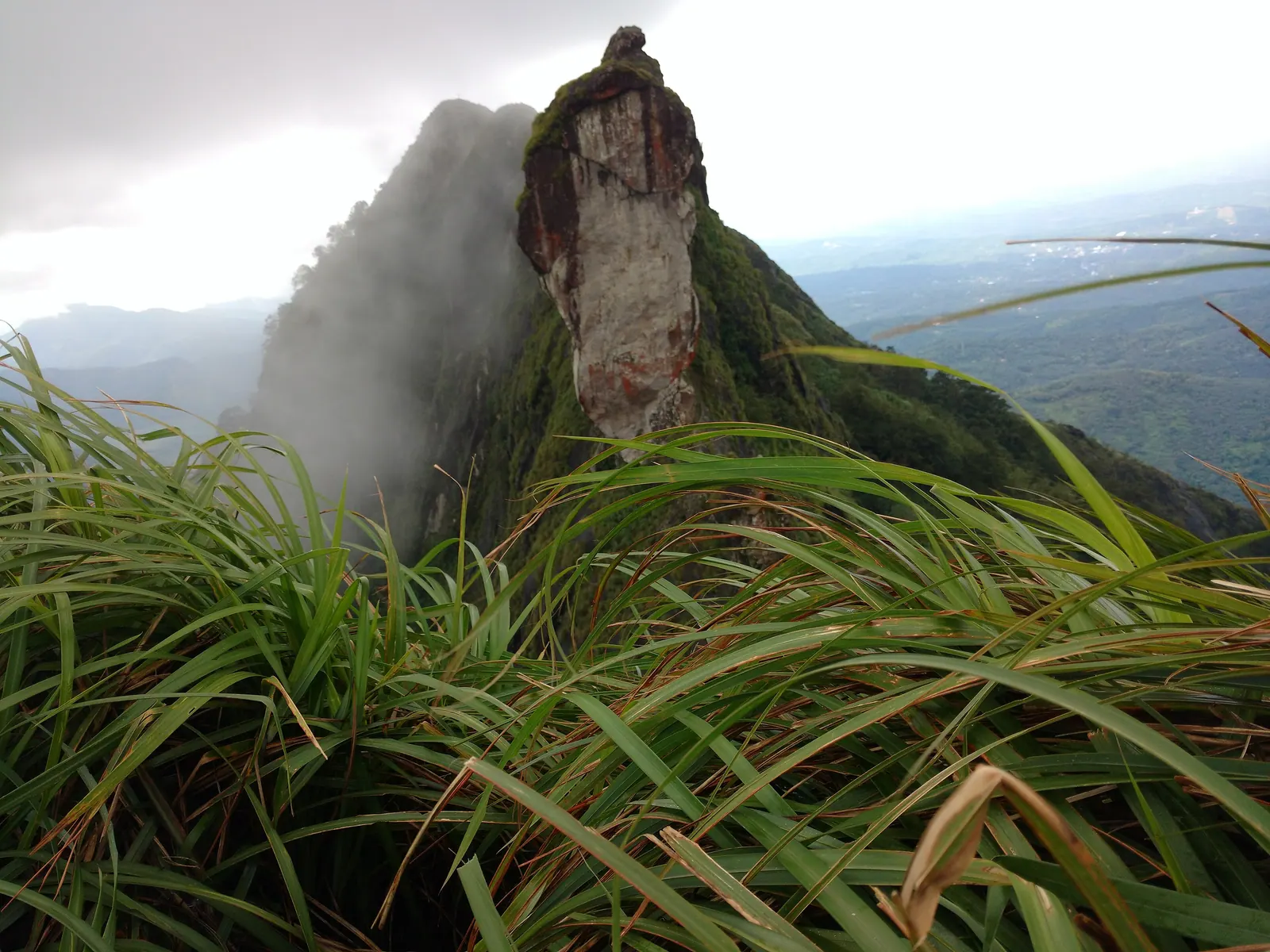
From the plains around Kottayam, the Western Ghats are a blue-green wall. Illikkal Kallu is one of the places where that wall becomes something you can stand on. The name belongs to the highest of three rocky hills above the Teekoy and Erattupetta country, and on a clear day the view runs across ridge after ridge towards the high ranges. It is a popular drive-and-climb, not a wilderness expedition, but the final section deserves respect.
Three rocks on one ridge
The group is usually described as three: Illikkal Kallu, Kuda Kallu and Koonu Kallu. Illikkal Kallu is the tallest, a bare granite shoulder with a sheer drop on one side. Kuda Kallu — the umbrella rock — has a shape that explains the name, and Koonu Kallu is the hump-backed companion. The hills sit at roughly a thousand metres, which is high enough for mist, wind and a noticeable drop in temperature, but not so high that the walk becomes a mountaineering exercise. The landscape is grassland and rock with patches of shola forest, grazed by cattle and cut by paths that are not always marked.
The drive and the final climb
The road climbs through rubber plantations, smallholdings and cardamom country, narrowing as it goes. The last stretch is steep and can be rough after rain; a car with decent clearance is more comfortable than a low hatchback, and a local driver who knows the passing places is worth the money. From the usual parking area, the walk is short but not flat. The path crosses grassland, then rock, and the final approach to the summit is often the part that is closed. Access to the top has been restricted at times after accidents, and the restriction is not a suggestion.
Do not assume that because other people are walking beyond a barrier, the barrier does not apply to you. Ask at the entry point or with a local guide what is currently permitted. If the summit is closed, the lower viewpoints still give you the ridge, the wind and most of the view.
Weather decides the day
In the monsoon the rock is slick, the grass is waist-high and leeches are active; the reward is a landscape at its most dramatic, but the risk is real. In winter, clear mornings are more likely, though the summit can be inside a cloud by midday. Lightning is a serious concern on an exposed ridge, and strong wind makes the final rock unpleasant even when it is open. Start early, watch the sky and turn back if the weather is building. This is not a place to insist on a plan.
What to carry, and how to behave
- Shoes with grip, not sandals; the rock is steep and often wet.
- Water and a light windproof layer; the ridge is cooler than the town.
- A cap and sun protection for the climb, even in misty weather.
- Cash for parking and any local guide; do not rely on card machines.
- Take your litter down. There are few bins and the wind moves loose plastic fast.
The surrounding land is farmland and grazing ground, not a theme park. Close gates, give cattle room, and ask before walking through planted areas. Local guides are a good idea not only for directions but because they know which paths are currently used and which have been closed. On weekends and public holidays the parking area fills early; a weekday morning is a different, calmer experience.
Sources & notes
- Kerala Tourism — official state tourism portal · checked 2026-10-22
- Wikipedia — place and history reference · checked 2026-10-22
Last updated 24 October 2026. Prices, opening hours and transport should be confirmed with official sources before travel.
Hello Kerala Publisher
Hello Kerala's editorial desk.
Found an error or an outdated detail?
Tell us